WHAT IT IS
Weather Station Kurt (German designation Wetter-Funkgerät Land 26, abbreviated WFL-26; literally "Weather Radio Device, Land, No. 26") was an unmanned, battery-powered, automatic meteorological station that the German Kriegsmarine set up on the shore of Martin Bay, on the Hutton Peninsula near Cape Chidley at the northern tip of Labrador, on 22–23 October 1943. It was carried across the North Atlantic inside the Type IXC/40 long-range U-boat U-537 and erected by her crew and two civilian specialists in a single, exhausting working shift of roughly 28 hours. Once switched on, it was designed to wake itself up every three hours, measure air pressure, air temperature, wind speed and wind direction, encode those readings mechanically into short groups of Morse letters, and broadcast the result as a burst of shortwave telegraphy on 3940 kHz before shutting itself down again. [DOCUMENTED]
It is the only armed German military installation known to have been set up on the soil of mainland North America during the Second World War. The landing took place on territory that was then part of the Dominion of Newfoundland (Labrador belonged to Newfoundland until Confederation with Canada in 1949), a detail that is often lost in popular retellings that describe the station as "on Canadian soil". [DOCUMENTED] For 34 years nobody on the Allied side knew it existed. It was stumbled upon in 1977, identified from German records in 1980, and recovered in 1981 by a Canadian expedition aboard the icebreaker CCGS Louis S. St-Laurent. The surviving hardware is today displayed in the Canadian War Museum in Ottawa. [DOCUMENTED]
This article treats Kurt the way the rest of this data base treats a transmitter site: as a piece of radio engineering. We go through the strategic reason it was built, the people who designed it, the voyage of U-537, every canister and mast on the hill above Martin Bay, the electromechanical clockwork that turned analog needle positions into Morse code with no standby current, and the RF and ionospheric physics of why a 150 W transmitter on a 10 m mast in northern Labrador very probably could not be heard reliably in Europe. Then we follow the station through its silent decades to the museum floor.
SOURCE QUALITY KEY
Every factual paragraph and table row in this article carries one of the following labels. The literature on Kurt is thin: almost all of it descends from three roots (the war diary of U-537, the research of Franz Selinger, and the 1981 Canadian Department of National Defence recovery report and the writing of W.A.B. Douglas). Popular articles very frequently copy each other, which can make a single original claim look like a consensus.
| Label | Meaning on this page |
| [DOCUMENTED] | Supported by primary records (U-537 war diary as quoted by historians, museum catalogue records, DND historical reports) or by several independent secondary sources. |
| [SINGLE-SOURCE] | Appears in only one traceable original source, even if repeated widely online. |
| [UNVERIFIED] | Commonly stated, but we could not trace it to an original record. |
| [ESTIMATE] | A number worked out by us from physics or from known similar equipment, not a recorded measurement. |
| [SPECULATION] | Reasoned interpretation; plausible but not proven. |
| [BACKGROUND] | General context (physics, the wider war) that is well established and not specific to Kurt. |
QUICK FACTS
| Parameter | Value / Specification | Source Label & Conflict Notes |
| Official designation | Wetter-Funkgerät Land, serial 26 (WFL-26) | [DOCUMENTED] Designation used in the Canadian War Museum record and in Selinger. |
| Nickname | "Kurt" | [SINGLE-SOURCE] Commonly said to honour Dr. Kurt Sommermeyer, the meteorologist aboard. Some writers suggest it was simply the station's radio call name. Neither explanation is proven by the war diary as quoted. |
| Operator | Kriegsmarine, Marinewetterdienst (Naval Weather Service) | [DOCUMENTED] |
| Manufacturer | Siemens & Halske / Siemens group, Berlin, with transmitter from C. Lorenz AG | [DOCUMENTED] for Siemens; [SINGLE-SOURCE] for the exact Lorenz model naming. |
| Carrier vessel | U-537, Type IXC/40, Kptlt. Peter Schrewe | [DOCUMENTED] |
| Landing site | Martin Bay, Hutton Peninsula, northern Labrador, about 32 km south of Cape Chidley | [DOCUMENTED] |
| Coordinates | about 60°05'00" N, 64°22'51" W | [DOCUMENTED] Matches the Canadian recovery site; individual sources differ in the last arc-second. |
| Set up | 22–23 October 1943 | [DOCUMENTED] |
| Elevation of site | about 52 m (170 ft) above sea level, roughly 400 m inland | [SINGLE-SOURCE] From the 1981 recovery descriptions. |
| Transmit frequency | 3940 kHz (75–80 m band) | [DOCUMENTED] |
| Transmitter power | about 150 W | [DOCUMENTED] as a nominal figure; real output into the antenna unknown. |
| Emission | A1 (on-off keyed CW telegraphy) | [DOCUMENTED] |
| Reporting cycle | Every 3 hours, about 2 minutes on air | [DOCUMENTED] for 3-hourly; the 2-minute length is [SINGLE-SOURCE]. |
| Sensors | Barometer, air thermometer, cup anemometer, wind vane (some accounts add a humidity sensor) | [DOCUMENTED] for the four main sensors; humidity is [UNVERIFIED] for WFL-26. |
| Power | Nickel-cadmium accumulator banks plus dry anode batteries in about 8 canisters | [DOCUMENTED] for NiCd use in the WFL family; exact chemistry per canister is [UNVERIFIED]. |
| Number of canisters | 10, about 100 kg each | [DOCUMENTED] |
| Masts | Antenna mast about 10 m; instrument mast | [DOCUMENTED] for a 10 m antenna mast; instrument mast height varies by source. |
| Design endurance | about 6 months | [SINGLE-SOURCE] Some sources say 3 months for the winter case. |
| Service life in practice | A few days to a few weeks | [DOCUMENTED] that it went silent early; the reason is disputed (see later). |
| Discovered | July 1977 by geomorphologist Peter Johnson | [DOCUMENTED] |
| Identified | 1980–1981 by Franz Selinger with W.A.B. Douglas | [DOCUMENTED] |
| Recovered | July 1981 by CCGS Louis S. St-Laurent | [DOCUMENTED] |
| Present location | Canadian War Museum, Ottawa | [DOCUMENTED] |
TERMS AND DESIGNATIONS
| Term / Designation | German / Expansion | Meaning and Context | Status |
| WFL | Wetter-Funkgerät Land | Automatic weather radio for use on land. Serial numbers 21 onward. | [DOCUMENTED] |
| WFS | Wetter-Funkgerät See | Automatic weather radio for use at sea, a buoy laid by a U-boat. | [DOCUMENTED] |
| Marinewetterdienst | Naval Weather Service | Kriegsmarine organisation that ran weather operations and received the reports. | [DOCUMENTED] |
| Wetterschiff | Weather ship | Converted trawlers stationed in the Atlantic to radio weather reports. | [DOCUMENTED] |
| Wettertrupp | Weather team | Small manned expeditions to Arctic islands. | [DOCUMENTED] |
| KTB | Kriegstagebuch | War diary kept by every U-boat commander. | [DOCUMENTED] |
| Morsewalze | Morse cylinder / coding drum | Rotating drum with Morse contact patterns used to encode readings. | [SINGLE-SOURCE] for its exact use in WFL-26. |
| Umformer | Rotary converter | Motor-generator that turns low DC voltage into high DC voltage for tube anodes. | [BACKGROUND] |
| Anodenbatterie | Anode battery | Dry battery stack giving high voltage directly. | [BACKGROUND] |
| DEAC | Deutsche Edison-Akkumulatoren-Company | German maker of nickel-cadmium and nickel-iron alkaline cells. | [BACKGROUND]; use in WFL-26 [UNVERIFIED]. |
| Steuersender | Master oscillator / driver | The frequency-setting stage of a transmitter. | [BACKGROUND] |
| Endstufe | Final stage | The RF power amplifier. | [BACKGROUND] |
| Huff-Duff | HF/DF, high-frequency direction finding | Allied network of shore and ship direction finders that located U-boat transmissions. | [BACKGROUND] |
| Ultra | Allied codeword for decrypted signals intelligence | Including naval Enigma decrypts from Bletchley Park. | [BACKGROUND] |
STRATEGIC CONTEXT: WHY GERMANY WAS WEATHER-BLIND
Weather over Western Europe is mostly made to the west. In the mid-latitudes the upper-level westerly flow steers low-pressure systems (cyclones) from North America across the North Atlantic toward the British Isles, Norway and Germany. Many of the deepest North Atlantic lows form or intensify where cold Arctic air coming off northern Canada and Greenland meets warm Gulf Stream air: in the Labrador Sea, off Newfoundland and south of Greenland. A forecaster in 1943 who wanted to predict the weather over the English Channel, the Bay of Biscay or the Norwegian Sea two or three days ahead needed observations from exactly those regions. [BACKGROUND]
Before the war, those observations came freely. Ships at sea, airfields and land stations in Canada, Newfoundland, Greenland, Iceland and the British Isles exchanged reports in internationally agreed codes, and any national weather service could copy them off the air. When war broke out in September 1939, the Allied countries enciphered their weather broadcasts or stopped them. Germany suddenly lost almost all real-time data from west of about 20° W. The Allies, by contrast, still had the whole of North America, Greenland (after the 1941 US–Danish agreement), Iceland (occupied by Britain in 1940 and then the US) and the big convoys at sea reporting to them. [DOCUMENTED]
This mattered for every branch of the German war effort. The Luftwaffe needed forecasts for bombing raids on Britain and for reconnaissance flights. The Kriegsmarine needed them for U-boat pack operations and for the breakout of heavy surface ships into the Atlantic. The army in occupied France and later in Russia used Atlantic weather to plan ahead. Large operations such as the Channel Dash of February 1942 depended on accurate forecasts of bad weather and low visibility. [DOCUMENTED]
THE WEATHER SHIPS AND THE ENIGMA CONNECTION
Germany's first answer was to put men at sea. Fishing trawlers were converted into Wetterschiffe (weather ships), given a meteorologist and a radio operator, and sent out to sit in the North Atlantic and the Arctic, sending coded weather reports home. The best known are München (often written Muenchen), Lauenburg, Sachsen, Coburg, Hinrich Freese and Wuppertal, but there were many more. [DOCUMENTED]
The weather ships turned out to be a serious security weakness. They carried naval Enigma machines and the paper key lists needed to set them. A small, lightly armed trawler alone in the ocean was an easy target. In May 1941 the Royal Navy deliberately hunted down München north-east of Iceland; the boarding party recovered Enigma key settings for June 1941. In June 1941 Lauenburg was captured near Jan Mayen, yielding the settings for July. These "pinches", planned with the help of Bletchley Park, together with the capture of material from U-110 in May 1941, let British codebreakers read the naval Enigma "Heimisch" (Dolphin) traffic quickly for months, and contributed directly to the hunting of German supply ships after the sinking of the battleship Bismarck. [DOCUMENTED]
The weather ships were also easy to find because they talked. Each regular weather report was a radio transmission that Allied HF direction finders could fix. By late 1941 the surviving weather ships had become suicide postings, and the Kriegsmarine started to move its weather effort onto land, to the far Arctic, and to U-boats. [DOCUMENTED]
MANNED ARCTIC STATIONS
From 1940 to 1945 Germany sent a long series of manned weather teams to Spitsbergen (Svalbard), Bear Island, Jan Mayen, Franz Josef Land and East Greenland. Typical operations carried names such as Holzauge, Bassgeiger, Edelweiss and Goldschmied (East Greenland), Kreuzritter, Knospe, Nussbaum and Haudegen (Spitsbergen), and Schatzgräber (Alexandra Land, Franz Josef Land). The men lived in huts or tents for a winter, sending weather reports several times a day. Many were found and attacked by Allied forces, Norwegian ski troops or the Danish/American sledge patrols in Greenland. The last German unit to surrender anywhere in the war was the Haudegen team on Nordaustlandet, Svalbard, which gave itself up to a Norwegian sealer in September 1945. [DOCUMENTED]
Manned stations produced the best data, but they were expensive, dangerous and every transmission was a beacon. A team that was discovered could be killed or captured along with its code books. Automatic stations solved part of this: no people to capture, no huts to bomb, and short transmissions that were harder to fix by direction finding. [DOCUMENTED]
Sub-article gap: The German Arctic "weather war" (Svalbard, Greenland, Jan Mayen and Franz Josef Land, the Allied counter-operations Gauntlet and Fritham, the sledge patrol fights in East Greenland, and the fate of Haudegen) is a big topic in its own right and deserves its own page in this data base. It is only summarised here.
THE AUTOMATIC STATION PROGRAMME: WFS AND WFL
The idea of a self-contained radio weather station was not new in 1940. Radiosondes (balloon-borne instrument packages with small transmitters) had been flying since the early 1930s, and several countries had experimented with unmanned ground stations. What the Kriegsmarine needed was something tougher: a station that could be hauled through a submarine hatch, carried up a hill by a few men, set up in hours, and then left alone to work through an Arctic winter. [DOCUMENTED]
Two families came out of this requirement:
According to Selinger's research, a production run of 26 WFL stations was ordered, carrying serial numbers starting at WFL-21, and about 14 were actually deployed between 1942 and 1945 at sites in Spitsbergen, Bear Island, Jan Mayen, East Greenland, Franz Josef Land, Novaya Zemlya (in the Soviet Arctic) and northern Labrador. [SINGLE-SOURCE] The exact serial range (21 to 46) and the exact deployment count vary slightly between retellings; some lists give 21 stations built. We present 26 and 14 as Selinger's figures, not as confirmed totals.
THE DESIGNERS
Most popular accounts credit two names with the WFL concept and its scientific design:
Industrial development is generally attributed to Siemens (Siemens & Halske and the Siemens-Schuckertwerke group in Berlin), which built the instrument and control parts and assembled the stations. [DOCUMENTED] The transmitter is attributed to C. Lorenz AG of Berlin-Tempelhof, the main supplier of naval shortwave sets. [SINGLE-SOURCE] The coding drum is often said to follow the work of Dr. Josef Graw, whose Berlin firm built radiosondes for the German weather service. [UNVERIFIED] We found no primary document linking Graw personally to the WFL programme; the link is an inference from the similarity between radiosonde coding mechanisms and the WFL encoder.
Dr. Kurt Sommermeyer, the meteorologist who travelled on U-537, is sometimes described as a Siemens employee and sometimes as a Marinewetterdienst scientist. He did take part in the design and testing of the stations, which is why he was sent to supervise the landing. [DOCUMENTED] The second civilian, the technician Walter Hildebrandt (sometimes spelled Hildebrant), was a Siemens mechanic or engineer. [DOCUMENTED for his presence; spelling varies]
WHY LABRADOR?
The Arctic WFL stations fed the Norwegian Sea and Barents Sea picture: they helped the Luftwaffe and Kriegsmarine in Norway and the attacks on Arctic convoys to Murmansk. But they told almost nothing about the weather coming into the main Atlantic battlefields and Western Europe. For that, a station far to the west was needed, at a place where it could catch lows forming over the Labrador Sea and Hudson Strait two or three days before they reached the British Isles. [DOCUMENTED]
Northern Labrador fitted. It was empty of people except a few Inuit families and seasonal Hudson's Bay Company posts. It had a long, broken, poorly charted coast where a submarine could close the shore. And it lay roughly 3,700 to 4,300 km from the Kriegsmarine receiving stations in Norway and Germany, far enough west to be useful, close enough (it was hoped) to be heard. A second station, WFL-35, was later earmarked for Labrador or Baffin Island as well (see later). [DOCUMENTED]
The choice of the Hutton Peninsula, rather than a site further south near Hopedale or Nain, came from operational limits: U-537 had to arrive before sea ice closed the coast, find a sheltered anchorage, and stay away from inhabited places and Allied traffic in Hudson Strait. [SPECULATION based on the war diary narrative as summarised by Douglas]
THE BOAT: U-537
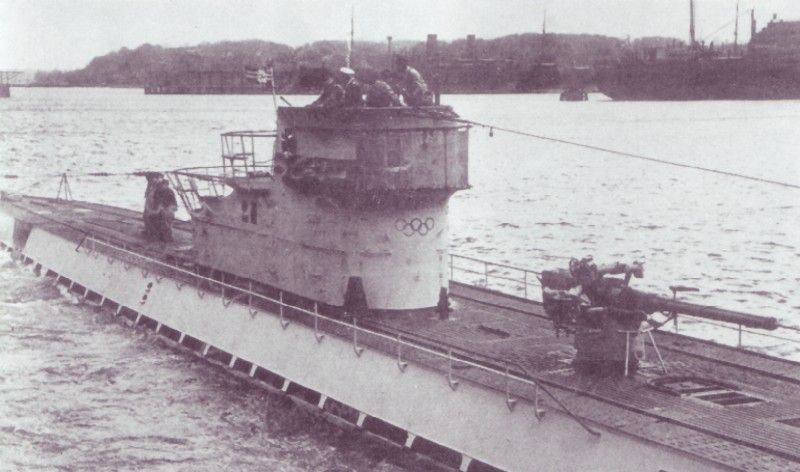
U-537 was a Type IXC/40 ocean-going U-boat built by Deutsche Werft in Hamburg-Finkenwerder and commissioned on 27 January 1943. The Type IXC/40 was the final, slightly enlarged version of the Type IXC long-range boat, with more fuel for operations far from the French bases, which made it the natural choice for a trans-Atlantic special mission. [DOCUMENTED]
| Parameter | Type IXC/40 (nominal) | Source Label & Conflict Notes |
| Surfaced displacement | about 1,144 t | [DOCUMENTED] standard reference value |
| Submerged displacement | about 1,257 t | [DOCUMENTED] |
| Length | 76.8 m | [DOCUMENTED] |
| Beam | 6.86 m | [DOCUMENTED] |
| Propulsion (surface) | 2 × MAN M9V 40/46 supercharged 9-cylinder diesels, about 4,400 PS total | [DOCUMENTED] |
| Propulsion (submerged) | 2 × Siemens-Schuckert electric motors, about 1,000 PS total | [DOCUMENTED] |
| Speed | about 19 knots surfaced, 7.3 knots submerged | [DOCUMENTED] |
| Range | about 13,850 nmi at 10 knots surfaced | [DOCUMENTED] |
| Torpedo tubes | 4 bow, 2 stern, 22 torpedoes | [DOCUMENTED] |
| Deck gun | 10.5 cm SK C/32 (often removed by late 1943) | [DOCUMENTED] for the class; U-537's exact fit in Sept 1943 [UNVERIFIED] |
| Anti-aircraft | 3.7 cm and 2 cm guns, including quadruple 2 cm Flakvierling 38 on many late boats | [UNVERIFIED] for the exact U-537 fit |
| Crew | 48–56 | [DOCUMENTED] |
Her commander was Kapitänleutnant Peter Schrewe, an experienced officer who had previously served on U-105. The weather station mission was U-537's first war patrol. [DOCUMENTED]
THE VOYAGE: KIEL, BERGEN AND THE STORM
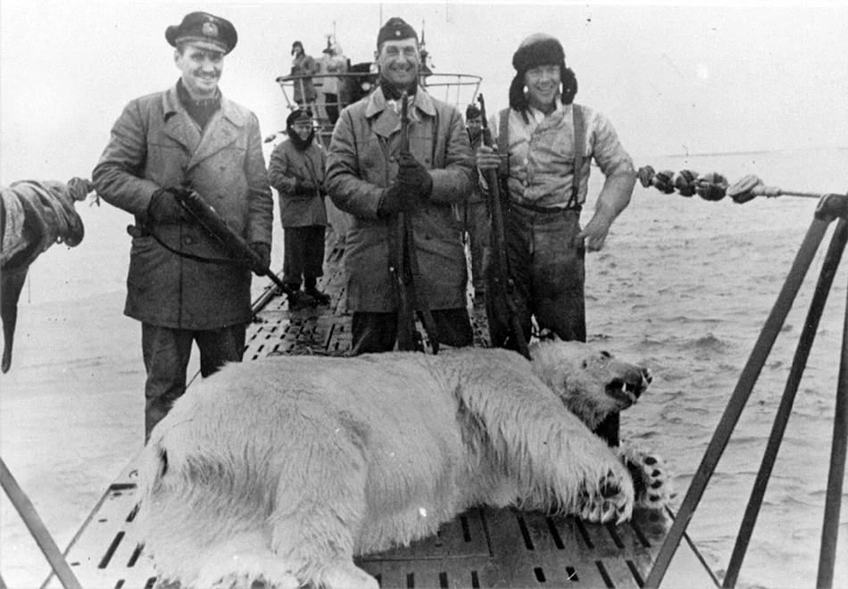
U-537 left Kiel on 18 September 1943 with the ten WFL-26 canisters, the two masts and tools stowed aboard. The bulky cylinders had to be loaded through the hatches and stowed in compartments that were already crowded with fuel, food and torpedoes; on a mission like this some torpedo stowage was usually given up. [DOCUMENTED for the departure date; stowage arrangement [SPECULATION]]
She called at Bergen, Norway, where she stayed from around 25 to 30 September 1943 before heading out into the Atlantic. Some accounts mention a stop for repairs or final fitting; the exact reason for the Bergen stay is not clear from the sources we have. [DOCUMENTED for the stop; reason [UNVERIFIED]]
On the way across, U-537 ran into a very heavy autumn storm in the waters south and south-west of Greenland. Waves damaged the boat's conning tower area. Several popular accounts say the quadruple 2 cm Flakvierling anti-aircraft mount was wrecked or torn away and that sea water got into the battery spaces. [SINGLE-SOURCE] Whatever the details, the boat arrived with reduced anti-aircraft protection, which made a long surface stop on an enemy coast even riskier. Seawater in a lead-acid battery compartment is a serious hazard, because salt water plus sulphuric acid can give off chlorine gas; any such leak would have been an emergency. [BACKGROUND]
Source conflict: We could not confirm from a primary source whether the anti-aircraft damage was to a single gun, a quad mount, or the bulwark (Wintergarten) platform, or whether battery damage happened at all. Treat the details as a story that circulates in secondary literature.
ARRIVAL OFF LABRADOR AND THE CHOICE OF MARTIN BAY
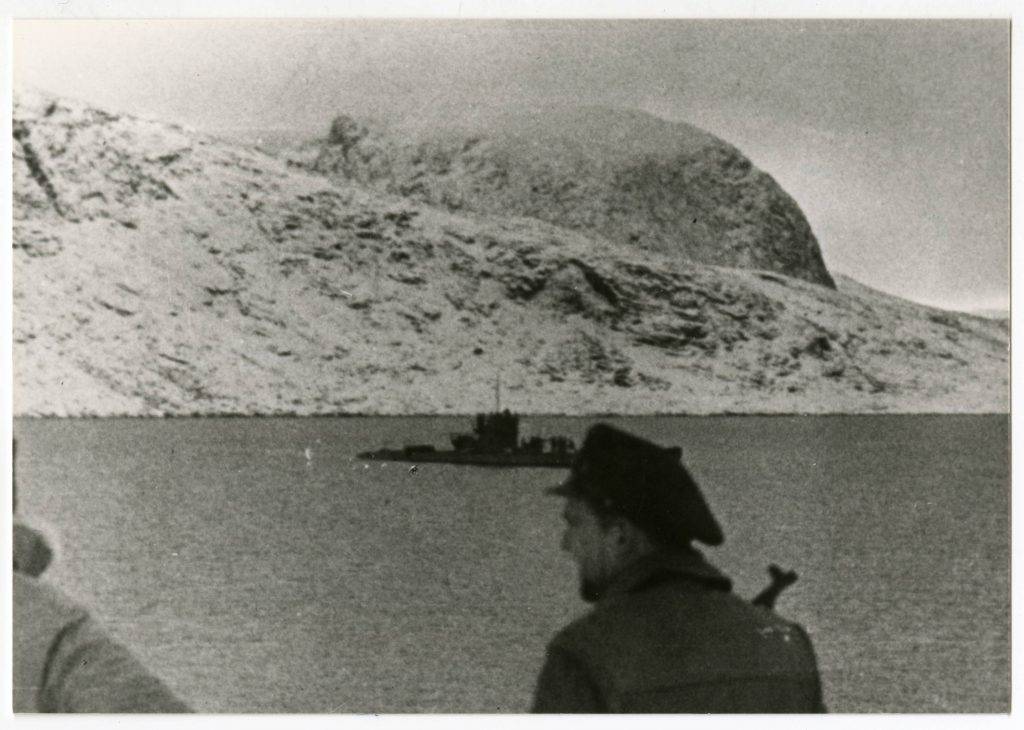
U-537 reached the northern Labrador coast on 22 October 1943. The area is one of the most exposed in the North Atlantic: tidal currents in the approaches to Hudson Strait are strong, the coast was poorly charted, and fog, snow squalls and icebergs are common in October. [DOCUMENTED]
Schrewe and Sommermeyer looked for a place that was sheltered from the open sea, had water deep enough to come close, and a clear, high spot inland where an antenna could see the sky and the sea to the east. They found it at Martin Bay on the eastern side of the Hutton Peninsula, about 32 km (20 miles) south of Cape Chidley, the northern tip of Labrador. [DOCUMENTED]
The boat anchored in shallow water close to shore. A watch was posted on the conning tower and, according to the usual account, men with weapons were posted on nearby high ground as lookouts while the rest worked. [SINGLE-SOURCE] Some writers add that an Allied vessel (described as an iceberg patrol ship or a small cargo vessel) passed nearby shortly before or during the landing without seeing the U-boat. [UNVERIFIED]
THE 28-HOUR LANDING
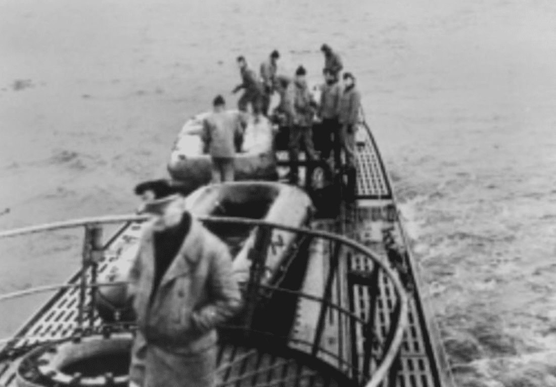
The work went on through the day and night of 22–23 October. Inflatable boats carried each part ashore. Each canister weighed roughly 100 kg (220 lb) and had to be manhandled out of a submarine hatch, lowered into a rubber dinghy in a swell, paddled ashore, and then carried up a rough slope of boulders and frost-shattered rock to the site, about 400 metres inland and roughly 50 metres above sea level. [DOCUMENTED for the general procedure; distances [SINGLE-SOURCE]]
| Step | Work | Notes |
| 1 | Anchor in shallow water, post lookouts | [DOCUMENTED] |
| 2 | Reconnoitre site on the high ground | [DOCUMENTED] |
| 3 | Ferry 10 canisters, 2 masts, cables, tools, guy anchors | [DOCUMENTED] |
| 4 | Carry everything up to the site | [DOCUMENTED] |
| 5 | Erect instrument mast and antenna mast with guy lines | [DOCUMENTED] |
| 6 | Connect canisters with cables; check sensors | [DOCUMENTED] |
| 7 | Switch on and test; listen for the first transmission | [DOCUMENTED] |
| 8 | Clean up and re-embark; sail | [DOCUMENTED] that the boat left within about 28 hours |
The time pressure was enormous. A U-boat at anchor on the surface cannot dive in an emergency; the entire crew ashore would have been lost if an aircraft or warship had come along. Schrewe's war diary records the whole operation as complete in a little over a day. [DOCUMENTED]
COVER STORY AND SECURITY MISTAKES
To discourage curious visitors, the Germans painted the words "Canadian Meteor Service" on one of the canisters. There was no such organisation; the real one was the Meteorological Division of the Department of Transport (often called the Meteorological Service of Canada). The aim was to make any trapper or hunter who found the station think it was Canadian property and leave it alone. [DOCUMENTED]
Source conflict: The exact wording varies. The Canadian War Museum and most original sources give "Canadian Meteor Service". Some retellings give "Canadian Meteorological Service" or "Canadian Meteorologic Service". We follow the museum's wording as the best-attested version.
There was another security weakness: Labrador in 1943 was Newfoundland territory, not Canada, so a "Canadian" label was a slight mismatch, though few local people would have noticed or cared. [SPECULATION]
The cover was also undercut by the crew. Accounts of the 1981 recovery mention German-labelled items left at the site, such as empty cigarette packets or food tins and other debris. [SINGLE-SOURCE] Whether these were really German, and how much of the material found in 1981 dated from 1943, is not certain; the site had been visited by other people in the intervening decades.
FIRST TRANSMISSIONS AND DEPARTURE
The station was switched on and its first transmissions were heard. The usual account says that U-537 received the station's signals locally and that they sounded correct. [DOCUMENTED] Whether the signals were also confirmed by a receiving station in Europe in the first days is less clear. Some accounts say the first reports were picked up in Germany or Norway and that the data reached the Marinewetterdienst; others say only the boat heard them and that the station was jammed or faded out quickly. [SOURCE CONFLICT, see the Operational Fate section]
U-537 sailed on 23 October 1943 and went on to patrol off Newfoundland. She attacked shipping without success, was attacked by aircraft, and returned to Lorient, France, arriving on 8 December 1943. [DOCUMENTED]
THE FATE OF U-537
U-537 later sailed for the Far East as part of the Monsun group of boats sent to operate from Penang and Jakarta (Batavia). On 9 November 1944, in the Java Sea east of Surabaya, she was torpedoed by the American submarine USS Flounder (SS-251) and sank with all 58 men aboard, including Schrewe. She was the only German U-boat sunk by a US submarine in the war. [DOCUMENTED] The war diary of her Labrador patrol survived because it had been handed in at Lorient after the patrol. Without it, Kurt would probably never have been identified.
THE SECOND LABRADOR STATION: WFL-35 AND U-867
A second automatic station, usually given as WFL-35, was assigned to the Type IXC/40 boat U-867 under Kapitän zur See Arved von Mühlendahl, a senior officer in his fifties who was unusually old for a U-boat commander. [DOCUMENTED] (Some sources give his rank as Korvettenkapitän or Fregattenkapitän; the rank is uncertain in secondary works.)
U-867 sailed from Norway in September 1944 to set up the station on the Labrador or Baffin coast. On 19 September 1944 she was attacked by an RAF Liberator of No. 224 Squadron north-west of Bergen and sank with all hands. [DOCUMENTED] Some accounts say she had already suffered diesel and battery problems and was trying to return; the exact sequence is disputed. [UNVERIFIED]
Source conflict: Not all lists agree that WFL-35 was the station on U-867 or that its target was Labrador rather than Baffin Island or Greenland. We treat WFL-35 on U-867 as the most common attribution.
OTHER WFL STATIONS (SUMMARY)
| Site | Approximate Date | Delivery | Notes |
| Bear Island | 1942–1944 | U-boat | Several stations reported; one of the most used sites. [SINGLE-SOURCE] |
| Spitsbergen (several) | 1942–1944 | U-boat / weather team | Some stations collected after operation. [SINGLE-SOURCE] |
| Jan Mayen | 1943–1944 | U-boat | Island also held by Norwegian forces. [UNVERIFIED] |
| East Greenland | 1943–1944 | U-boat / ship | Overlaps with manned stations. [UNVERIFIED] |
| Novaya Zemlya | 1943–1944 | U-boat | Soviet Arctic; reported only in German sources. [UNVERIFIED] |
| Franz Josef Land | 1943–1944 | Aircraft / ship | Associated with Schatzgräber area. [UNVERIFIED] |
| Northern Labrador (WFL-26 Kurt) | Oct 1943 | U-537 | Only one on North American mainland. [DOCUMENTED] |
| Labrador/Baffin (WFL-35) | Sept 1944 | U-867 | Boat lost en route. [DOCUMENTED] |
Sub-article gap: A full table of every WFL serial with site, date and boat is beyond the scope of this page; Selinger's German-language book is the main source and has not been fully translated.
THE ALLIED SIDE OF THE WEATHER WAR
The Allies had their own Arctic weather problem, and their solution explains why Labrador was empty of Allied observers in 1943. The United States built a chain of weather and air ferry stations across Greenland (the "Bluie" stations such as Bluie West 1 at Narsarsuaq and Bluie West 8 at Søndre Strømfjord), and Canada and the US built stations in northern Quebec and Labrador (the "Crystal" stations, including Crystal I at Fort Chimo, Crystal II at Frobisher Bay and Crystal III on Padloping Island) mainly to support the ferry route for aircraft flying to Britain. [DOCUMENTED]
These stations were concentrated where airfields and ferry routes ran: Goose Bay, Fort Chimo, Frobisher Bay and southern Greenland. The far northern tip of Labrador, at Cape Chidley, was outside this network. The nearest Allied station to Martin Bay was probably at Fort Chimo, several hundred kilometres to the southwest, or on the southern coast of Baffin Island across Hudson Strait. [DOCUMENTED for station list; distances [ESTIMATE]]
The Allies also ran weather patrols: aircraft flying long weather reconnaissance tracks, and ships of the US Coast Guard Greenland Patrol. The famous Greenland Patrol fought small actions against German weather teams in East Greenland, including the capture of the German trawler Externsteine in October 1944. [DOCUMENTED]
WFS: THE SEA BUOY VERSION IN MORE DETAIL
The WFS sea stations deserve a fuller description, because they used similar engineering. A WFS was a long steel cylinder that floated upright when released. Inside were batteries, a timer, a pressure sensor (the barometer was the main instrument at sea), sometimes a thermometer, a coding device and a small transmitter. A short antenna mast extended above the water when the buoy was floating. Some versions were anchored in shallow water; most drifted. [SINGLE-SOURCE for detail]
At sea, the antenna problem is reversed: sea water is an excellent ground, so even a short vertical on a buoy has low ground loss. A WFS with a short antenna at sea could therefore radiate a larger share of its power than a WFL on rock, although wave motion and spray made reception unsteady. [ESTIMATE]
The buoys had very short lives, partly because storms damaged them and partly because they drifted out of the useful region. They were mainly laid in the North Atlantic west of the British Isles and in the Norwegian and Barents seas. [SINGLE-SOURCE]
THE BIGGER PICTURE: WEATHER AND D-DAY
The most famous weather forecast of the war, the one that let General Eisenhower launch D-Day on 6 June 1944 during a short break in bad weather, was made by Allied forecasters with access to observations from the western Atlantic that the Germans lacked. German forecasters, short of western data, believed the weather would stay too rough for a landing in early June, and several senior German commanders were away from their posts. [DOCUMENTED]
Kurt, of course, was long silent by then and was in any case only one station. But the D-Day story shows exactly why Germany was willing to risk a U-boat for weather data from Labrador: the side with better Atlantic observations could choose its moment. [BACKGROUND / SPECULATION]
STATION LAYOUT ON THE HILL
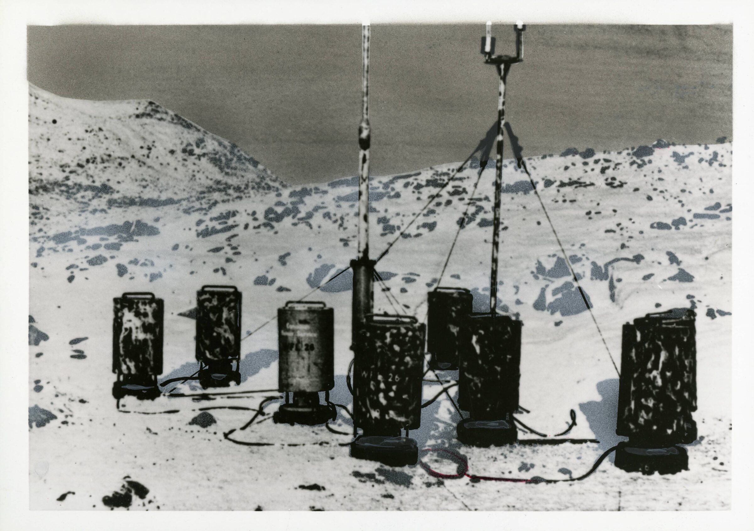
The finished station stood on a rocky rise above Martin Bay. Its layout followed the general WFL pattern: a cluster of upright steel cylinders standing or lying together, a short instrument mast close by, and a taller antenna mast held up by guy wires, with cables joining everything. [DOCUMENTED]
| Item | Number | Approximate Size | Function | Source Label |
| Instrument and control canister | 1 | about 1.0–1.5 m long, about 0.45–0.5 m diameter | Barometer, clockwork timer, coding mechanism, relays | [DOCUMENTED] for function; size [ESTIMATE] |
| Transmitter canister | 1 | same as above | 150 W shortwave transmitter and antenna matching | [DOCUMENTED] |
| Battery canisters | about 8 | same as above, about 100 kg each | NiCd accumulators and dry batteries | [DOCUMENTED] for "most canisters held batteries" |
| Instrument mast | 1 | a few metres high | Anemometer, wind vane, thermometer | [DOCUMENTED] |
| Antenna mast | 1 | about 10 m | Vertical radiator | [DOCUMENTED] |
| Guy wires and anchors | several | Hold masts in wind; anchored with rocks/stakes | [DOCUMENTED] | |
| Interconnecting cables | several | Power, sensor signals, RF feed | [DOCUMENTED] |
Size conflict: The Canadian War Museum describes the canisters as about the size of a large oil drum. Some sources say about 1 m long, others closer to 1.5 m. The brief figures of 1.0 m by 0.45–0.50 m and about 100 kg each are consistent with a container holding roughly 50–70 kg of cells, but they are [ESTIMATE] rather than measured values.
The canisters were painted a dark grey or olive colour and had carrying handles and end caps sealed with rubber gaskets and bolts to keep out moisture. [SINGLE-SOURCE] Sealing was critical: condensation inside a cold metal can at the coast will soak paper-insulated cables and corrode contacts within weeks.
WHY CANISTERS?
Splitting the station into ten cylinders was a direct result of how it was delivered. A U-boat's main deck hatches and torpedo loading hatches limited what could come aboard; a cylinder about half a metre across could pass through the torpedo loading hatch and could be stowed in torpedo racks or between machinery. Ten separate 100 kg loads were also something four men could carry over rock without lifting gear. [SPECULATION based on Type IX hatch dimensions]
Separate battery canisters also made the station modular. More battery canisters meant longer life; the same instrument and transmitter canisters could be used everywhere. This fits Selinger's description of a standard WFL kit adapted to each site. [SPECULATION]
THE POWER SYSTEM
The station had to run for months without any outside power, in temperatures that can fall to about -30 to -40 °C in a Labrador winter, with strong winds. Everything depended on stored chemical energy. [DOCUMENTED]
Sources agree that the bulk of the weight was batteries. The usual description is nickel-cadmium (NiCd) alkaline accumulators, with dry batteries for high-voltage anode supplies. [DOCUMENTED for NiCd in the WFL family; per-canister chemistry [UNVERIFIED]] Germany had a strong alkaline battery industry; the DEAC company (Deutsche Edison-Akkumulatoren-Company) made nickel-cadmium and nickel-iron cells and supplied the armed forces. [BACKGROUND] Whether the WFL-26 cells were DEAC products is not confirmed.
NiCd cells have important advantages for this use compared with lead-acid cells:
Their main disadvantage is lower cell voltage (1.2 V instead of 2.0 V), so more cells are needed. [BACKGROUND]
Source conflict on chemistry: Several popular sources describe the batteries simply as "dry cells", some as "nickel-cadmium", and some as "nickel-iron". The Canadian War Museum record says the station was powered by batteries without detail. We cannot settle this from available sources. The brief's figure of 400–800 V anode stacks is [UNVERIFIED]; a 150 W transmitter of the period more usually ran its anodes at 1,000–2,000 V, which could be produced by a rotary converter (Umformer) from a 12–24 V low-voltage bank rather than by dry batteries.
WORKED POWER BUDGET [ESTIMATE]
We can check whether ten canisters could plausibly run the station for six months. This is our own estimate, not a recorded figure.
| Item | Assumption | Result |
| Transmissions per day | 8 (every 3 hours) | 8 |
| Transmit time each | 2 minutes total on, including warm-up | 16 minutes/day |
| Days | 180 | 2,880 minutes = 48 hours total transmitting |
| DC input power while on | 150 W RF at about 50% transmitter efficiency, plus filaments and converter losses: about 400 W | 400 W |
| Energy for transmissions | 48 h × 400 W | 19.2 kWh |
| Clock and standby | near zero for spring clock; small winding motor | under 1 kWh |
| Cold derating | NiCd capacity reduced about 30–50% at -30 °C | need about 30–40 kWh nominal |
| NiCd energy density (1940s) | about 20–30 Wh/kg | 1,000–2,000 kg of cells |
The answer is that roughly 1,000 kg or more of NiCd cells would be needed for six months at 8 transmissions per day with a 400 W draw, which matches the total station weight of about one tonne surprisingly well. [ESTIMATE] If the real input power was lower (shorter transmissions, lower power) the six-month claim becomes easy; if it was higher, three months is more realistic. Both figures appear in the literature.
THE ANTENNA MAST
The radiator was a tubular mast about 10 metres (33 ft) high, assembled from sections and held up by guy wires anchored to rocks. It worked as a vertical monopole, with the transmitter's output connected at its base. [DOCUMENTED for 10 m and vertical form]
| Feature | Description | Source Label |
| Height | about 10 m | [DOCUMENTED] |
| Construction | sectional tube, telescoping or slip-fit | [SINGLE-SOURCE] |
| Material | steel or light alloy | [UNVERIFIED] |
| Base | insulated from ground on a ceramic or bakelite insulator | [SPECULATION] required for a base-fed monopole |
| Ground system | wires laid out on the rock as a counterpoise | [SPECULATION] no buried radials were possible |
| Matching | coil/tuning network in transmitter canister or at mast base | [SPECULATION] |
On bare rock nothing can be buried, so any ground system had to be a few wires laid on the surface or wedged between boulders. This has a very large effect on the station's efficiency, worked out in the RF section below.
THE INSTRUMENT MAST AND SENSORS
The meteorological instruments were mounted on a separate short mast or tripod so they would read free air rather than air warmed by the canisters. Most accounts give the following set. [DOCUMENTED]
| Sensor | Probable Type | How It Talks to the Controller | Source Label |
| Wind speed | 3-cup anemometer | Contact closing once per revolution or per set number of turns; counted by a stepping mechanism | [DOCUMENTED] for cup anemometer; contact method [SPECULATION] |
| Wind direction | Wind vane | Shaft with a contact disc dividing the circle into sectors (8, 16 or 32 points) | [DOCUMENTED] vane; sector count [UNVERIFIED] |
| Air temperature | Bimetal or liquid-in-metal (Bourdon) thermometer with radiation shield | Pointer read by the coding mechanism | [SPECULATION] |
| Air pressure | Aneroid barometer in the instrument canister | Pointer read by the coding mechanism | [DOCUMENTED] for barometer |
| Humidity | Hair hygrometer (some WFL versions) | Pointer | [UNVERIFIED] for WFL-26 |
The anemometer and vane had to deal with icing, which is the classic killer of unattended arctic instruments. Freezing fog and sea spray coat cups and vanes with rime ice within hours. A WFL had no heating to spare, so wind readings were probably unreliable or stuck for long periods in winter. [SPECULATION]
THE CLOCK AND THE WAKE CYCLE
The heart of an unattended station is its timer. The WFL system is described as using a spring-driven precision clock whose mainspring was rewound electrically at intervals, so that the clock itself drew almost no power. [SINGLE-SOURCE] Cams or contacts on the clock closed a master relay at the scheduled times. [SPECULATION for the exact mechanism]
A plausible reconstruction of each cycle, based on standard 1940s automatic-station practice, is as follows. [SPECULATION]
| Time from Wake (s) | Event |
| 0 | Clock cam closes main relay; low-voltage bus connected |
| 0–20 | Tube filaments heat; rotary converter spins up; high voltage builds |
| about 10–20 | Barometer and thermometer pointers clamped against the coding surface so they cannot move while being read |
| 20 | Coding drum motor starts; call sign/identifier sent |
| 20–110 | Readings sent as Morse groups, possibly repeated |
| 110–120 | Drum completes revolution; relays open; transmitter off |
| 120 onward | Clamp released; all power off except clock |
The great virtue of this design is that between transmissions the only thing running is a clock. A tube receiver or a tube-based logic circuit could never have survived months on batteries in standby; the WFL avoided that problem completely. [BACKGROUND]
HOW A CODING DRUM TURNS A NEEDLE INTO MORSE
This is the part of the design that most deserves to be explained, because it shows how analog-to-digital conversion was done without electronics.
Principle: Imagine a cylinder made of insulating material that rotates at a steady speed. Along its length are many narrow tracks, side by side, each going around the circumference. On each track, raised metal contacts are laid out in the pattern of a different Morse letter or group: a short contact for a dot, a long contact for a dash, gaps between. A thin pointer (from the barometer, say) lies across the drum, its tip resting above one of the tracks. When a clamping bar presses the pointer down onto the drum, the pointer touches whatever track lies under its tip. As the drum rotates, the contacts on that track pass under the pointer and close and open the circuit in a Morse pattern. That circuit keys the transmitter. [BACKGROUND, principle used in radiosondes and automatic stations]
So the position of the pointer along the drum axis selects a Morse group, and the group identifies the reading. If the pointer swings from low pressure to high pressure across the drum, it passes over a sequence of tracks, each with its own group. This is mechanical quantisation: the continuous analog value is divided into as many steps as there are tracks.
| Example Track Number | Morse Group on Track | Meaning (from calibration table only) |
| 1 | AA |
lowest pressure step |
| 2 | AB |
next step |
| ... | ... | ... |
| 40 | XY |
highest pressure step |
The table above is illustrative only; we do not know the real groups used in WFL-26. [SPECULATION]
Resolution: The number of distinguishable tracks is limited by contact width and pointer accuracy. With tracks about 1 mm wide on a drum perhaps 100–150 mm long, roughly 100 steps are possible. Over a barometer range of 950–1050 hPa, that gives about 1 hPa per step; over a temperature range of -40 to +30 °C, about 0.7 °C per step. The brief's figure of 0.5 hPa steps is optimistic but not impossible. [ESTIMATE]
Clamp: The clamping bar (in German sources sometimes called a Fallbügel, "drop bar", a term borrowed from recording instruments) is essential. A barometer pointer is driven by a very weak force from the aneroid capsule; it cannot itself press against contacts or carry current reliably. The bar presses it down only during reading, then lifts it so it moves freely again. This same "chopper bar" technique was used in industrial recorders of the period. [BACKGROUND]
Keying speed: Because the drum turns at a fixed speed, the Morse is sent at a fixed machine speed. Sources do not give the WFL keying speed. At 60–120 words per minute a skilled operator would struggle; the receiving station would record the signal on tape or an undulator and read it afterward. [ESTIMATE]
Wind encoding: Direction is easy: the vane shaft can carry its own commutator with sector contacts, each wired to select one Morse group. Speed is harder, because it needs a count over time. A counter driven by the anemometer contacts during a fixed interval (say one minute before transmission) could set a stepping switch, which in turn selected the Morse group. [SPECULATION]
WHY THE CODE ACTED AS A CIPHER
Because the link between each Morse group and the physical value existed only on a calibration sheet for that particular station, an enemy listener who copied the transmission heard only meaningless letters. To use the data he would need the calibration table, the order of the readings and the station's identifier. In effect the hardware itself provided a simple substitution code. [SPECULATION based on the description of WFL coding]
This is not real cryptographic security: with weeks of intercepts and Allied weather data for the same area, an analyst could probably reconstruct the scale by correlation. But it delayed recognition, and more importantly, it meant no Enigma machine or key list was at risk on the station. [SPECULATION]
Sub-article gap: The Graw radiosonde family and the Morse-drum principle used in German upper-air soundings (such as the Graw H-series) deserve a separate technical article.
SURVIVING THE LABRADOR WINTER: COLD-WEATHER ENGINEERING
The environment at Martin Bay is harsher than most people imagine for 60° N. The cold Labrador Current runs south along the coast, bringing sea ice from Baffin Bay and icebergs from West Greenland. Mean January temperatures in the Cape Chidley area are around -20 °C, with extremes well below -35 °C; winds above 100 km/h are common in autumn and winter storms; and freezing fog and wet snow coat exposed surfaces in rime ice. [BACKGROUND]
Every part of the station faced a specific failure mode in these conditions.
| Component | Cold-Weather Threat | Likely Mitigation in 1943 | Residual Risk | Label |
| Batteries | Capacity loss, electrolyte freezing | Alkaline chemistry, insulation, mass of cells as thermal buffer | Capacity falls 30–50% at -30 °C | [ESTIMATE] |
| Clock | Lubricant thickening, mainspring torque change | Low-temperature oils, electrical rewinding keeping spring in narrow torque range | Rate drift; possible stoppage | [SPECULATION] |
| Relays and contacts | Ice and condensation on contacts, oxidation | Sealed canisters, desiccant, silver or platinum contacts | Intermittent contact; missed transmissions | [SPECULATION] |
| Tubes | Filament thermal shock, slow warm-up | Pre-heat period in each cycle | Little; tubes cope well with cold | [BACKGROUND] |
| Rotary converter | Bearing grease stiffening; brush wear | Arctic grease | Slow spin-up; reduced high voltage | [SPECULATION] |
| Cables | Insulation cracking (rubber goes brittle) | Special compounds | Short circuits at flex points | [SPECULATION] |
| Anemometer / vane | Rime icing | None known | Stuck readings | [SPECULATION] |
| Masts and guys | Ice load, wind | Guying | Mast collapse in extreme storm | [SPECULATION] |
| Canister seals | Thermal cycling, pressure changes | Rubber gaskets, bolted lids | Moisture ingress over months | [SPECULATION] |
Thermal behaviour: A sealed canister full of batteries has a large heat capacity. When the station transmitted, the transmitter tubes and the batteries' internal resistance generated a little heat. Over a winter the canisters would follow the outside temperature with a lag of hours to a day, smoothing out short cold snaps but not the long cold of January. [ESTIMATE]
Condensation: Each time warm, moist air that was trapped at assembly cooled, its water condensed on the coldest surface, usually the canister wall. Over many cycles water would collect at the bottom. Canisters lying on their side in 1981 may have had water damage. [SPECULATION]
Clock rewinding: The reason for electrically rewinding a spring clock rather than using a pure electric clock is efficiency and stability. A synchronous electric clock needs constant AC; a DC motor clock wastes power continuously; a pendulum clock is upset by wind. A spring clock with a small motor that tops up the spring a few times a day draws power only for seconds and runs on a nearly constant spring torque. [BACKGROUND]
THE RECEIVING SIDE: HOW A REPORT BECAME A FORECAST
A report from Kurt was only useful if it reached a forecaster in time. The probable chain was:
Value of a single station: Synoptic forecasting in 1943 depended on drawing isobars and fronts from scattered observations. A single pressure value and its trend at the entrance to the Labrador Sea would let a forecaster place an approaching low and estimate its deepening. Pressure tendency (rise or fall over three hours) is the single most useful number from an isolated station. Even without wind or temperature, a reliable pressure series from Labrador would have improved German two- and three-day forecasts for the eastern Atlantic. [BACKGROUND / SPECULATION]
Sub-article gap: The German wartime weather service organisation (Reichswetterdienst, Luftwaffe and Kriegsmarine weather branches) and their codes would be a useful separate page.
THE STATION FROM AN ALLIED POINT OF VIEW
The Allies were aware that Germany used automatic weather stations and buoys. Ultra intercepts referred to some of them, and British and Norwegian forces destroyed or captured several Arctic stations. [DOCUMENTED in general] There is no evidence that Kurt itself appeared in Allied intelligence. [UNVERIFIED]
Had the Allies found it, they could have done several things: destroyed it, captured it intact to study the design, or (more cleverly) left it alone and studied its transmissions to learn German coding of weather stations. Allied intelligence did use captured German stations to gain information in other cases. [SPECULATION]
WHY A U-BOAT?
Delivering a weather station by U-boat was very costly. A Type IXC/40 boat could otherwise have spent weeks hunting convoys. However, by late 1943 the U-boat campaign was going badly: the Allies had broken the naval Enigma, long-range aircraft covered most of the Atlantic, and wolf packs were suffering heavy losses for little result. A special mission like this gave a boat a useful task with relatively lower risk, since it avoided convoys. [SPECULATION]
The commander was also expected to carry out a normal war patrol after the landing, which U-537 did off Newfoundland, so the boat was not entirely lost to the offensive. [DOCUMENTED]
LANDING OPERATIONS IN NUMBERS [ESTIMATE]
| Item | Estimate | Basis |
| Total mass landed | about 1,000–1,200 kg | 10 canisters at about 100 kg plus masts and cables |
| Number of men ashore | about 8–15 | typical boat party plus civilians |
| Dinghy trips | about 10–20 | one or two canisters per trip |
| Climb to site | about 400 m horizontal, about 50 m vertical | from site description |
| Lifting work | about 1,200 kg × 50 m × 9.81 m/s² ≈ 590 kJ | only the potential energy, ignoring friction and carrying effort |
| Time ashore | most of about 28 hours | war diary summary |
The potential energy is not large in itself; the real difficulty was carrying awkward, heavy, slippery cylinders over boulders in the dark and cold, with the constant threat of being caught on the surface.
CHOOSING THE SITE: RADIO AND METEOROLOGY TRADE-OFFS
The site choice reflects several competing demands:
A site about 50 m up and 400 m inland is a reasonable compromise. [SPECULATION]
THE GROUND SYSTEM PROBLEM IN MORE DETAIL [ESTIMATE]
The ground loss figure is the biggest single uncertainty in the efficiency estimate, so it is worth explaining why it is so large on rock.
A vertical monopole's return current flows through the ground in a region within roughly a quarter to half a wavelength of the base. At 3.94 MHz, that is a circle about 20–40 m in radius. If this region is good conductor (sea water, or a dense mat of buried radials), loss is low. If it is dry rock, the current must pass through high-resistance material, dissipating power. [BACKGROUND]
On granite with conductivity around 10⁻⁴ S/m, the skin depth at 4 MHz is δ = sqrt(2 / (ω μ σ)) = sqrt(2 / (2π × 3.94 × 10⁶ × 4π × 10⁻⁷ × 10⁻⁴)) ≈ 25 m, meaning the current spreads deep into the rock, but the resistivity (10,000 Ω·m) is so high that loss is heavy anyway. A few surface wires form a counterpoise that couples capacitively to the ground and carries part of the return current, but with only a handful of wires, most of the field still couples into the rock. [ESTIMATE]
| Ground System | Typical R_g at 4 MHz (short vertical) | Efficiency (R_rad 6.8 Ω, coil 1.8 Ω) |
| Perfect ground plane | about 0 Ω | about 79% |
| 120 buried radials, average soil | about 2 Ω | about 64% |
| 16 radials, average soil | about 10–15 Ω | about 29–36% |
| 4 surface wires on rock | about 30–60 Ω | about 10–17% |
| Sea water at base | about 1–2 Ω | about 65–70% |
This table is approximate; it shows why the location of a vertical antenna (on rock versus near sea water) mattered more than the transmitter power.
An irony: had the antenna been set up at the shoreline with its counterpoise in the sea, efficiency might have quadrupled. But a mast on the beach would be visible and exposed to storms and sea ice. [SPECULATION]
RECONSTRUCTING THE LINK BUDGET [ESTIMATE]
Combining the antenna and propagation numbers, a rough night-time link budget to northern Norway:
| Item | Value |
| Transmitter output | 150 W (+51.8 dBm) |
| Antenna efficiency | -8.5 dB |
| Low-angle gain (vertical over poor ground) | about -3 to -6 dBi |
| Free-space spreading loss at 3,740 km, 3.94 MHz | about 116 dB |
| Ground reflection losses (2–3 hops) | about 3–6 dB |
| Ionospheric absorption (quiet night) | about 5–10 dB |
| Auroral absorption (disturbed night) | about 10–30 dB extra |
| Receiving antenna gain | about 0 to +6 dBi |
| Received power (quiet night) | about -85 to -95 dBm |
| Received power (disturbed night) | about -95 to -125 dBm |
| Atmospheric noise at 4 MHz at night in 500 Hz bandwidth | about -110 to -120 dBm |
On a quiet night, the signal could be 15–30 dB above noise, clearly readable. On a disturbed night, it could fall to or below noise. In daytime, it would almost certainly be lost. This is consistent with a station that was heard at first but whose reception was unreliable. [ESTIMATE]
THE TRANSMITTER
The transmitter is usually identified as a Lorenz 150 W shortwave set of the Lo 150 FK family, the standard medium-power shortwave transmitter of the Kriegsmarine, which was installed on surface ships and in shore stations (for the shipboard and U-boat radio context see U-Boat Radio Room). [SINGLE-SOURCE for the exact model] Some writers give the designation Lo 150 FK 41 and suggest that a special version without manual tuning was built for the automatic station. We found no primary document giving the model with certainty, so the following description is of the general Lorenz 150 W naval transmitter design, not a confirmed WFL-26 schematic.
| Stage | German Term | Function | Source Label |
| Master oscillator | Steuersender | Sets the frequency; crystal-controlled or a stable LC oscillator | [BACKGROUND] |
| Buffer / multiplier | Trennstufe / Vervielfacher | Isolates oscillator from load; may double frequency | [BACKGROUND] |
| Power amplifier | Endstufe | Class C amplifier delivering about 150 W | [BACKGROUND] |
| Output network | Antennenanpassung | Pi network or loading coil to match the antenna | [BACKGROUND] |
| Keying | Tastung | Relay keys oscillator or driver stage; CW A1 | [BACKGROUND] |
| Power supply | Umformer / Netzteil | Rotary converter or vibrator for high voltage | [BACKGROUND] |
Typical German power tubes in this class included the RS 241, RS 384 and RL 12 P 35 families. Which tubes the Kurt transmitter used is [UNVERIFIED].
For an unattended station, crystal control is the only sensible choice: an LC oscillator would drift with temperature from a warm October afternoon to a -35 °C January night by several kilohertz, possibly out of the receiving station's passband. A crystal held in a small insulated oven would be best, but an oven costs power. A crystal without an oven would still drift only by tens to hundreds of hertz, which was acceptable. [ESTIMATE]
Sub-article gap: The Lorenz Lo 150 FK / Lo 40 K / Lo 800 FK Kriegsmarine transmitter family deserves its own article covering the shipboard installations, tube lineups and frequency ranges.
RF ANALYSIS: A 10 M VERTICAL AT 3940 kHz
This section works through the antenna physics using standard textbook formulas. All numbers are our own estimates. [ESTIMATE throughout]
Wavelength:
At f = 3.940 MHz, the free-space wavelength is λ = c / f = 299.792 / 3.940 = 76.09 m. A quarter-wave vertical would be 19.02 m (62.4 ft) high. The Kurt mast at about 10 m is only h / λ = 0.131 λ, or an electrical length of about 47°.
Radiation resistance:
For a short monopole over a perfect ground with a roughly triangular current distribution, radiation resistance is approximately R_rad ≈ 40 π² (h / λ)² = 394.8 × 0.01727 ≈ 6.8 Ω. A more exact sinusoidal current calculation for βh = 0.825 rad gives a slightly higher value, about 7 Ω.
Base reactance:
Using the thin-antenna approximation X ≈ -60 (ln(2h/a) - 1) / tan(βh), with a tube diameter of about 25 mm (a = 0.0125 m): ln(20 / 0.0125) - 1 = ln(1600) - 1 = 7.38 - 1 = 6.38; 60 × 6.38 = 383; tan(47.3°) = 1.084; so X ≈ -353 Ω (capacitive).
Loading coil:
To cancel -353 Ω at 3.94 MHz requires L = 353 / (2π × 3.94 × 10⁶) ≈ 14.3 μH. Even with a good coil of Q = 200, the coil loss is R_coil = 353 / 200 ≈ 1.8 Ω. A field coil in a cold, damp canister might have Q nearer 100, giving 3.5 Ω.
Ground loss:
The site is on Precambrian granite and gneiss with thin soil and permafrost. Typical ground conductivity is 10⁻⁴ to 10⁻³ S/m, roughly 10 to 100 times worse than average farmland. With a few counterpoise wires laid on the surface rather than dozens of buried radials, the ground loss resistance of a short vertical at 4 MHz is typically 30 to 60 Ω. We take 40 Ω.
Efficiency:
η = R_rad / (R_rad + R_coil + R_g) = 6.8 / (6.8 + 1.8 + 40) = 6.8 / 48.6 ≈ 14%, or about -8.5 dB.
| Quantity | Value |
| Transmitter output | 150 W |
| Efficiency | about 14% |
| Radiated power | about 21 W |
| Power lost in coil | about 5.6 W |
| Power lost in ground | about 123 W |
In other words, most of the transmitter's power went into warming the rocks around the base of the mast.
Low-angle loss:
For long paths, the signal needs to leave at low elevation angles, roughly 5° to 15°. A vertical over poor ground has a pseudo-Brewster angle, below which the ground reflection cancels much of the direct wave. Over rock of poor conductivity at 4 MHz, the pseudo-Brewster angle is around 10° to 15°, and the gain at 5° to 10° is several dB below the perfect-ground value. A loss of 6 to 10 dB at the useful angles is plausible. [ESTIMATE] Note, though, that a sea-front site helps: the station overlooked salt water to the east, and the far-field reflection point for low angles might fall partly on the sea, which would reduce this loss. This is a real uncertainty in the analysis.
PATH GEOMETRY
Great-circle distances from Martin Bay (60.08° N, 64.38° W), computed by us on a spherical Earth: [ESTIMATE]
| Destination | Distance | Initial Bearing |
| Tromsø, Norway | about 3,740 km | about 039° |
| Narvik, Norway | about 3,745 km | about 041° |
| Trondheim, Norway | about 3,725 km | about 051° |
| Bergen, Norway | about 3,665 km | about 058° |
| Norddeich, Germany | about 4,190 km | about 067° |
| Kiel, Germany | about 4,290 km | about 064° |
| Reykjavik, Iceland (for comparison) | about 2,210 km | about 060° |
The brief's figures (about 3,550 km to Tromsø and 4,150 km to Kiel) are slightly different from our calculation; our numbers use the coordinates listed above and should be preferred. Which receiving station actually listened for Kurt is [UNVERIFIED].
All these paths cross southern Greenland or pass just south of it, then cross the Denmark Strait and Iceland. That route runs right through the auroral zone, roughly 62° to 70° geomagnetic latitude, where ionospheric conditions are very different from mid-latitudes. [BACKGROUND]
IONOSPHERIC ABSORPTION AT 3.94 MHz
HF signals travel long distances by refraction in the F layer (about 200–400 km up). On the way up and down they pass through the D layer (60–90 km) and lower E layer, where collisions between electrons and neutral molecules absorb energy. This non-deviative absorption is roughly proportional to the electron density times collision frequency, divided by the square of the wave frequency: L ∝ ∫ N_e ν dz / (ω² + ν²). For HF, where ω ≫ ν, the loss in decibels falls approximately as 1/f². [BACKGROUND]
A more careful form uses (f + f_H)² where f_H is the electron gyrofrequency, about 1.3–1.5 MHz at high latitudes, for the dominant mode. That reduces the advantage of higher frequencies somewhat, but the trend is the same. [BACKGROUND]
| Frequency | Simple 1/f² Ratio vs 3.94 MHz | With (f + 1.4 MHz)² |
| 3.94 MHz | 1.0 | 1.0 |
| 7.0 MHz | 0.32 (3.2 times less loss) | 0.40 (2.5 times less) |
| 14.0 MHz | 0.079 (12.6 times less) | 0.12 (8.3 times less) |
Daytime: On a 4,000 km path, a 4 MHz signal needs two or three hops. Each hop passes twice through the sunlit D layer. Total daytime absorption at 4 MHz on such a path is typically tens of dB, enough to wipe out a 20 W signal. [ESTIMATE]
Night: The normal D layer largely disappears at night, which is why 80-metre DX happens after dark. But in the auroral zone, energetic electrons from the magnetosphere keep ionising the D and E layers, particularly during geomagnetic disturbances. This auroral absorption can last hours and reach 10–20 dB or more at 4 MHz, while 7 or 14 MHz suffer much less. [BACKGROUND]
Solar cycle: Solar cycle 17 reached its minimum around early 1944. Near solar minimum, F-layer critical frequencies are low, which helps a 4 MHz signal stay below the maximum usable frequency at night but makes higher frequencies less available. The declining phase before minimum is also known for recurrent geomagnetic storms from coronal holes, which increase auroral absorption. [BACKGROUND] Whether there was a specific disturbance in late October 1943 is [UNVERIFIED]; historical geomagnetic index records could be checked.
Polar cap absorption: Large solar proton events cause severe absorption over the polar caps for days. No such event is known for October–November 1943, so this is a possibility rather than an explanation. [SPECULATION]
WHY 3940 kHz?
The WFL design was mainly for the European Arctic. The paths from Svalbard to northern Norway (about 950 km), from Jan Mayen to Trondheim (about 1,160 km) and from East Greenland to Tromsø (about 1,380 km) are one-hop paths. During the polar night the F-layer critical frequency can be as low as 2.5–4.5 MHz; at 7 or 14 MHz the signal might pass straight through the ionosphere and be lost into space. A frequency near 4 MHz was a sensible choice for these short paths. [ESTIMATE / SPECULATION]
For Labrador, the path to Europe is three to four times as long, crosses the auroral zone, and requires low-angle radiation. Under those conditions, 4 MHz is close to the worst choice in the HF band. [ESTIMATE]
WHAT WOULD HAVE WORKED BETTER? [SPECULATION]
| Option | Effect on 10 m Mast | Propagation | Net |
| 3.94 MHz (actual) | 0.13 λ, R_rad about 7 Ω, efficiency about 14% | High absorption, auroral losses | Poor |
| about 7.0–7.5 MHz | close to quarter wave, R_rad about 36 Ω, efficiency over 50% with the same ground | 2.5–3 times less absorption; good at night | Much better |
| about 14 MHz | close to half wave, high impedance end-fed; low-angle radiation | about 8–12 times less absorption; daytime/twilight DX | Good when MUF allows |
| Dual frequency (7 and 14 MHz) | Needs switching; adds complexity | Covers day and night | Best |
At 7 MHz, with R_rad of about 36 Ω and the same 40 Ω ground loss, efficiency would be about 36 / (36 + 1 + 40) ≈ 47%, more than three times better than at 3.94 MHz, giving about 70 W radiated instead of about 21 W. Combined with about 4–5 dB less absorption per hop at night, the improvement in received signal could easily be 10–15 dB. [ESTIMATE]
A practical option within 1943 technology would have been a frequency in the 6–8 MHz range at night and a higher one in daytime, with the clock switching crystals according to the time of day, a technique commercial stations already used. Whether this was considered is unknown. [SPECULATION]
Caveat: This analysis assumes the receiving station was in Norway or Germany. If Kurt's reports were intended to be relayed by U-boats at sea in the western Atlantic, the path was much shorter and 3.94 MHz becomes far more reasonable. Some sources hint that U-boats were expected to listen. [UNVERIFIED]
ALLIED DIRECTION FINDING
Every transmission from a German station was potentially detected by the Allied high-frequency direction-finding network (HF/DF, "Huff-Duff"), which by 1943 included stations in Canada, Newfoundland, Greenland, Iceland and Britain. [BACKGROUND] A short burst of two minutes every three hours is harder to fix than a long operator-sent message, but HF/DF operators with fast-reading equipment could still take bearings on transmissions of a few seconds.
There is no known Allied record of Kurt being located by HF/DF. This could mean its signals were never heard; or that they were heard but not recognised; or that the records have not been found. [SPECULATION]
Sub-article gap: Allied HF/DF in the Battle of the Atlantic (shore networks, shipborne FH 4 sets, and their role with Ultra) is a major topic deserving its own article.
OPERATIONAL FATE IN 1943
What happened to Kurt after U-537 left is the least certain part of its history. The best-attested facts are: the station worked when U-537 tested it; transmissions were heard; and it stopped being useful within a short time, usually given as days to a few weeks. [DOCUMENTED] Beyond that the explanations differ.
| Explanation | Argument For | Argument Against | Label |
| Jamming | Some accounts say the frequency was jammed soon after transmissions began. | No Allied record of jamming has been found; Allies did not know the station existed. Jamming of an unknown station would be surprising. Interference from another transmitter on or near 3940 kHz is more plausible than deliberate jamming. | [UNVERIFIED] |
| Equipment failure | Freezing, condensation, battery leakage, relay contacts icing, mechanical clock problems all likely in a Labrador winter. | Station was designed for Arctic conditions; other WFL units ran for months. | [SPECULATION] |
| Propagation failure | Analysis above shows weak radiated power, high absorption on a long auroral path. Signals heard at first could have faded as autumn conditions changed or a geomagnetic disturbance arrived. | Does not explain why signals heard locally would stop. | [ESTIMATE] |
| Physical damage | Wind or ice brought down the antenna mast. | Masts were found standing or nearby in 1981; condition after 38 years says little about 1943. | [SPECULATION] |
Source conflict: Some writers say that "only U-537 heard the station" and that it was never received in Europe; others say reports reached the Marinewetterdienst for a short period. Douglas and Selinger, the most careful sources, describe early reception and then failure. We cannot resolve this. The likeliest combined picture, in our view, is that the station transmitted for some time, that reception in Europe was marginal and intermittent from the start, and that some combination of interference and equipment problems ended its usefulness. [SPECULATION]
THIRTY-FOUR YEARS OF SILENCE
After the war, there was no reason for anyone on the German side to talk about Kurt. Schrewe and his crew were dead. The station's records were in the war diary, which passed to the Allies with the captured German naval archives and later went back to West Germany. Sommermeyer and Hildebrandt survived the war, but there is no evidence either made the station public. [DOCUMENTED for the records; personal histories [UNVERIFIED]]
On the Canadian side, nobody suspected anything. The Hutton Peninsula is remote; occasional visits by hunters, Hudson's Bay Company staff, surveyors or the military would have found some old cylinders with "Canadian Meteor Service" on one of them, and many would have assumed it was a Canadian installation, exactly as intended. [SPECULATION]
1977: PETER JOHNSON
In July 1977 Peter Johnson, a geomorphologist from the University of Ottawa doing fieldwork in northern Labrador, came across the canisters. He noted the label and assumed the station was an old Canadian weather installation. [DOCUMENTED] At that time nobody linked it to Germany.
1980–1981: FRANZ SELINGER AND ALEC DOUGLAS
Franz Selinger, a retired Siemens engineer, had been researching German wartime weather stations for years for a book. In the German military archives he found the record of U-537's mission, with descriptions and position of the Labrador station. [DOCUMENTED] He contacted Dr. W.A.B. (Alec) Douglas, official historian at the Canadian Department of National Defence Directorate of History. Douglas linked Selinger's account to Johnson's 1977 report. [DOCUMENTED]
Selinger's later book on German Arctic weather stations, Von "Nanok" bis "Eismitte": Meteorologische Unternehmungen in der Arktis 1940–1945, published in 2001, is the main German-language reference on the programme. [DOCUMENTED]
THE 1981 RECOVERY
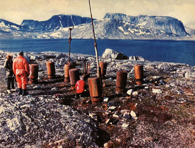
In July 1981 a Canadian expedition including Douglas and Selinger travelled to Martin Bay aboard the Canadian Coast Guard icebreaker CCGS Louis S. St-Laurent. They found the station still on its hill. [DOCUMENTED]
What they found, according to the descriptions, included: [DOCUMENTED for the general condition; detail [SINGLE-SOURCE]]
The damage is usually blamed on hunters or other visitors who opened the canisters looking for anything useful. [SPECULATION]
The parts were taken by helicopter to the ship and then to Ottawa, where they were conserved and restored. [DOCUMENTED]
THE CANADIAN WAR MUSEUM
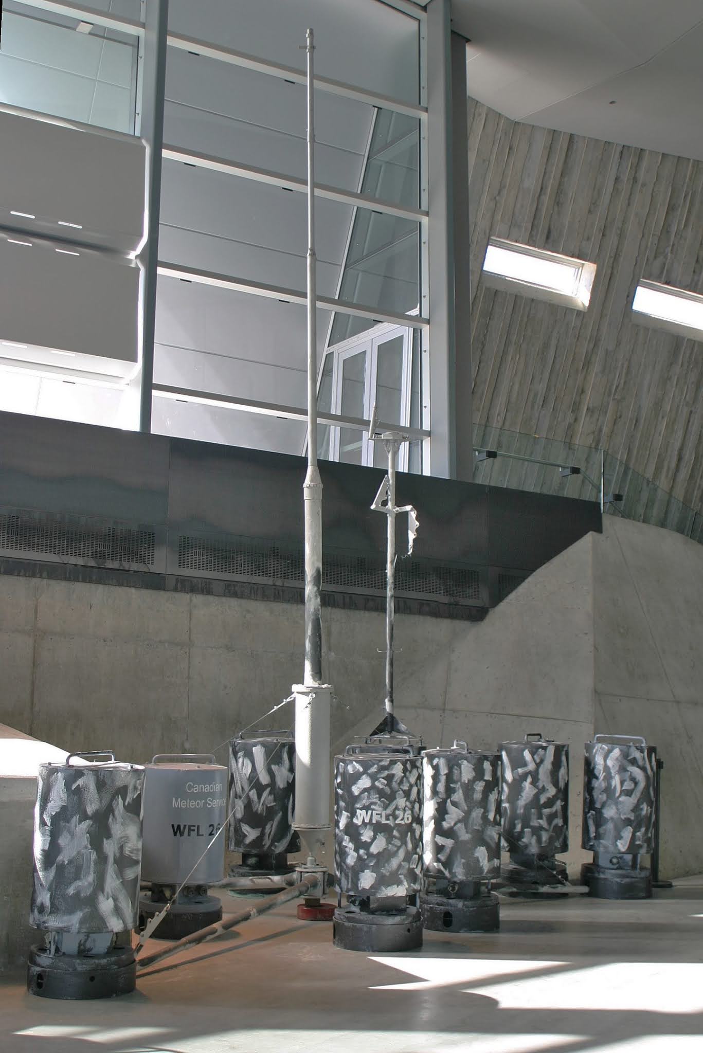
The restored station is displayed at the Canadian War Museum in Ottawa, set up as it would have stood on the Labrador hill, with canisters in camouflage paint, the "WFL 26" and "Canadian Meteor Service" markings, and both masts. [DOCUMENTED] It is one of the few surviving WFL stations anywhere.
WHAT KURT TELLS US
Seen as an engineering project, Kurt shows both the strengths and the weaknesses of German wartime technology:
It also shows how weather became a strategic resource in the Atlantic war, worth risking a submarine for.
COMPARISON WITH OTHER SYSTEMS
| System | Era | Type | Power | Frequency | Endurance | Notes |
| WFL-26 Kurt | 1943 | Automatic land weather station | about 150 W | 3.94 MHz | weeks (designed for months) | Labrador |
| WFS buoys | 1942–1945 | Automatic sea weather buoy | lower | HF | weeks | U-boat laid [UNVERIFIED power] |
| German manned Arctic stations | 1940–1945 | Manned | varied | HF | one winter | Haudegen, Knospe, etc. |
| Allied Greenland stations | 1941–1945 | Manned | varied | HF | permanent | Bluie stations [BACKGROUND] |
| Modern automatic weather stations | today | Automatic | small | Satellite | years | Solar, GOES/Argos [BACKGROUND] |
TIMELINE
| Date | Event | Label |
| Sept 1939 | Allied weather broadcasts enciphered or stopped | [DOCUMENTED] |
| 1940–1941 | German weather ships operate in Atlantic | [DOCUMENTED] |
| 7 May 1941 | Weather ship München captured; Enigma material recovered | [DOCUMENTED] |
| 28 June 1941 | Weather ship Lauenburg captured near Jan Mayen | [DOCUMENTED] |
| 1942 | First WFL stations deployed in Arctic | [SINGLE-SOURCE] |
| 27 Jan 1943 | U-537 commissioned | [DOCUMENTED] |
| 18 Sept 1943 | U-537 leaves Kiel | [DOCUMENTED] |
| about 25–30 Sept 1943 | U-537 at Bergen | [DOCUMENTED] |
| Early Oct 1943 | Storm damage off Greenland | [SINGLE-SOURCE] |
| 22 Oct 1943 | U-537 arrives at Martin Bay | [DOCUMENTED] |
| 22–23 Oct 1943 | WFL-26 erected and tested | [DOCUMENTED] |
| 23 Oct 1943 | U-537 departs | [DOCUMENTED] |
| Late Oct–Nov 1943 | Station goes silent or unusable | [DOCUMENTED] general; date [UNVERIFIED] |
| 8 Dec 1943 | U-537 arrives at Lorient | [DOCUMENTED] |
| 19 Sept 1944 | U-867 with WFL-35 sunk NW of Bergen | [DOCUMENTED] |
| 9 Nov 1944 | U-537 sunk by USS Flounder, all 58 lost | [DOCUMENTED] |
| Sept 1945 | Haudegen team surrenders on Svalbard | [DOCUMENTED] |
| July 1977 | Peter Johnson finds station | [DOCUMENTED] |
| 1980–1981 | Selinger and Douglas identify it | [DOCUMENTED] |
| July 1981 | Recovery by CCGS Louis S. St-Laurent | [DOCUMENTED] |
| Afterward | Displayed at Canadian War Museum | [DOCUMENTED] |
OPEN QUESTIONS AND SOURCE GAPS
FREQUENTLY ASKED QUESTIONS
Was Kurt the only German landing in North America? It is the only known armed German military installation set up on the North American mainland in the war. German agents were landed by U-boat on the US east coast in 1942 (Operation Pastorius) and in Canada (a spy landed at New Carlisle, Quebec, in 1942), but those were people, not installations. [DOCUMENTED]
Was the station armed or booby-trapped? No evidence suggests the station itself had weapons or explosive charges. Some German Arctic stations carried self-destruct devices; none is recorded for Kurt. [UNVERIFIED]
Could Inuit or trappers have reported it? Possibly some saw it; if so, the "Canadian Meteor Service" label would have made it look normal. There is no record of a report. [SPECULATION]
Why did the label say Canadian when Labrador was part of Newfoundland? Germans may not have known or cared about the distinction, or assumed Canadian weather staff worked across the region. Canada did run military and weather facilities in Labrador during the war, including the big air base at Goose Bay, so a Canadian label was not unreasonable. [SPECULATION]
Did the Allies ever find out in wartime? No evidence. [UNVERIFIED]
Why is it called Kurt? Probably after Dr. Kurt Sommermeyer, but this is not proven. [SINGLE-SOURCE]
Is anything left at Martin Bay? The main hardware was removed in 1981. Small debris, anchor points or marks may remain. The site lies within or near the area of today's Torngat Mountains National Park region of northern Labrador, though the Hutton Peninsula itself is near the park's northern edge; visiting requires charter transport and is subject to Inuit land claim and park rules. [UNVERIFIED for the exact park boundary]
Could amateurs reproduce the signal path today? The 80 m amateur band includes 3.94 MHz in some countries (it sits in the North American 75 m phone segment), and amateurs regularly make Labrador to Europe contacts on 80 m at night with good antennas and kilowatt power. A 20 W ERP CW signal across the auroral zone is a difficult but not impossible path on a quiet winter night near solar minimum, which matches our link budget. [BACKGROUND / ESTIMATE]
THE PEOPLE
| Person | Role | Fate | Label |
| Kptlt. Peter Schrewe | Commander of U-537 | Killed when U-537 sank, 9 Nov 1944 | [DOCUMENTED] |
| Dr. Kurt Sommermeyer | Meteorologist aboard; supervised station | Survived the war | [DOCUMENTED] presence; later life [UNVERIFIED] |
| Walter Hildebrandt | Technician aboard | Later life unknown | [UNVERIFIED] |
| Dr. Ernst Ploetze | Physicist, credited with design | Unknown | [SINGLE-SOURCE] |
| Edwin Stöbe | Engineer, credited with design | Unknown | [SINGLE-SOURCE] |
| Arved von Mühlendahl | Commander of U-867 (WFL-35) | Killed 19 Sept 1944 | [DOCUMENTED] |
| Peter Johnson | Geomorphologist; found station 1977 | [DOCUMENTED] | |
| Franz Selinger | Retired Siemens engineer, researcher | Identified station; book 2001 | [DOCUMENTED] |
| Dr. W.A.B. (Alec) Douglas | DND official historian | Led identification and recovery | [DOCUMENTED] |
LEGACY
Kurt is now a well-known curiosity of the Second World War, appearing in Canadian school materials, museum guides, and online articles. Its value to historians is that it is a rare physical example of the German automatic weather station programme, intact enough to study. Its value to engineers is as a case study: a clever, compact, low-standby-power design undermined by a mismatch between its radio parameters and the path it was asked to cover. [SPECULATION]
For radio enthusiasts, it is a reminder that antenna efficiency and frequency choice usually matter more than transmitter power, and that high-latitude HF paths behave very differently from the mid-latitude paths most operators know. [BACKGROUND]
RELATED ARTICLES IN THIS DATA BASE
SOURCES
IN ONE SENTENCE
Weather Station Kurt (WFL-26) was a ten-canister, clock-driven automatic weather station that the U-boat U-537 secretly set up on a hill above Martin Bay in northern Labrador on 22–23 October 1943, using an ingenious electromechanical drum to turn barometer, thermometer and wind readings into Morse code bursts on 3940 kHz, but whose roughly 150 W transmitter feeding a short 10 m mast over bare granite, on a frequency chosen for short Arctic paths rather than a 4,000 km auroral-zone crossing to Europe, probably left it barely audible before it fell silent, unknown to the Allies until a geomorphologist found it in 1977 and a Canadian expedition recovered it for the Canadian War Museum in 1981.
RELATED U-BOAT ARTICLES